
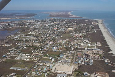
Planning & Zoning
Mission Statement
To provide professional advice and technical expertise in regards to short and long term planning issues, for our citizens, elected officials, appointed boards and commissions, and city staff, pursuant to city ordinaces and the comprehensive plan.
To continually work and develop our long term commitment to secure a strong economic base, safeguarding our environment through development guidelines governed by quality master plans, implementation and development reviews.
Comprehensive Planning
Adopted Plans
Coastal Management Plan
Drainage Master Plan
Moving Forward Port A - Appendix
Moving Forward Port A Comprehensive Plan (Adopted 2023.04.20)
Nature Preserve Plan
Parks and Open Space Master Plan 2023
Port Aransas Stormwater Management Plan and Ordinances 2021.3.30 Final
Historical Plans
Economic Plan
Facilities Master Plan (call for information)
Future Land Use Map
Pedestrian & Bike Mobility Plan
Thoroughfare Plan
Transportation Plan
Street Design Specifications
Street Design Specifications
Plans Under Construction
Airport Master Plan
Utilities Master Plan
Development Fees
Dune Permitting
| Development Fees | Fee |
| Preliminary Plat | $365.00 + $15 per lot-plus actual engineering |
| Final Plat | $365.00 + $15 per lot-plus actual engineering costs associated with final plat and post final plan reviews of development |
| Minor Plat | $265.00 + Engineering Costs |
| Zoning Request Change | $350.00 |
| Special Use Permit Request | $350.00 plus actual engineering costs |
| Board of Adjustments & Appeals Request (Call Building Dept.) |
$330.00 |
| Street Closing Request | $300.00 - plus actual engineering costs |
| Alley Closing Request | $300.00 - plus actual engineering costs |
| Beachfront Construction Certificate | $85.00 |
| Dune Permit (area only includes that within dune protection area) |
$350.00 plus actual engineering costs |
| Permit Research | $22.00 per hour |
Example Dune Permit
Flow chart for Dune permits process
Flow chart for beach front construction
No Dune Permit Example
City Maps
Existing Land Use Map
Future Land Use Map
City Base Map
Beach Maintenance Committee Report
Port Aransas Nature Preserve
Master Drainage Plan
Planning On-Line Forms
Development Forms
Application Zoning Change
Final Plat Application
Minor Plat Application
Preliminary Plat Application
Application Alley-Street Abandonment
Special Use Application
Impact Fee Ordinance
Marina Study 2014
FEMA Maps
Please click on the links below to view the Nueces County Flood Insurance Rate Map (FIRM) and incorporated areas. Additional and individual Flood Map information can be found at this interactive site "http://maps.riskmap6.com/TX/Nueces/"
Downloadable PDF:
FIRM Map 1 of 3
FIRM Map 2 of 3
FIRM Map 3 of 3
Rick Adams
Planning & Development Director
Phone: 361-749-4111, Ext. 233
Nicole Boyer
Planning & Development Assistant
Phone: 361-749-4111, Ext. 234